The UAE just launched a satellite that can “see” way more than photos
The UAE has launched Arab Satellite 813, the first Arab hyperspectral Earth-observation satellite. Here’s what HSI, PAN and AP mean, plus how open data will be used.

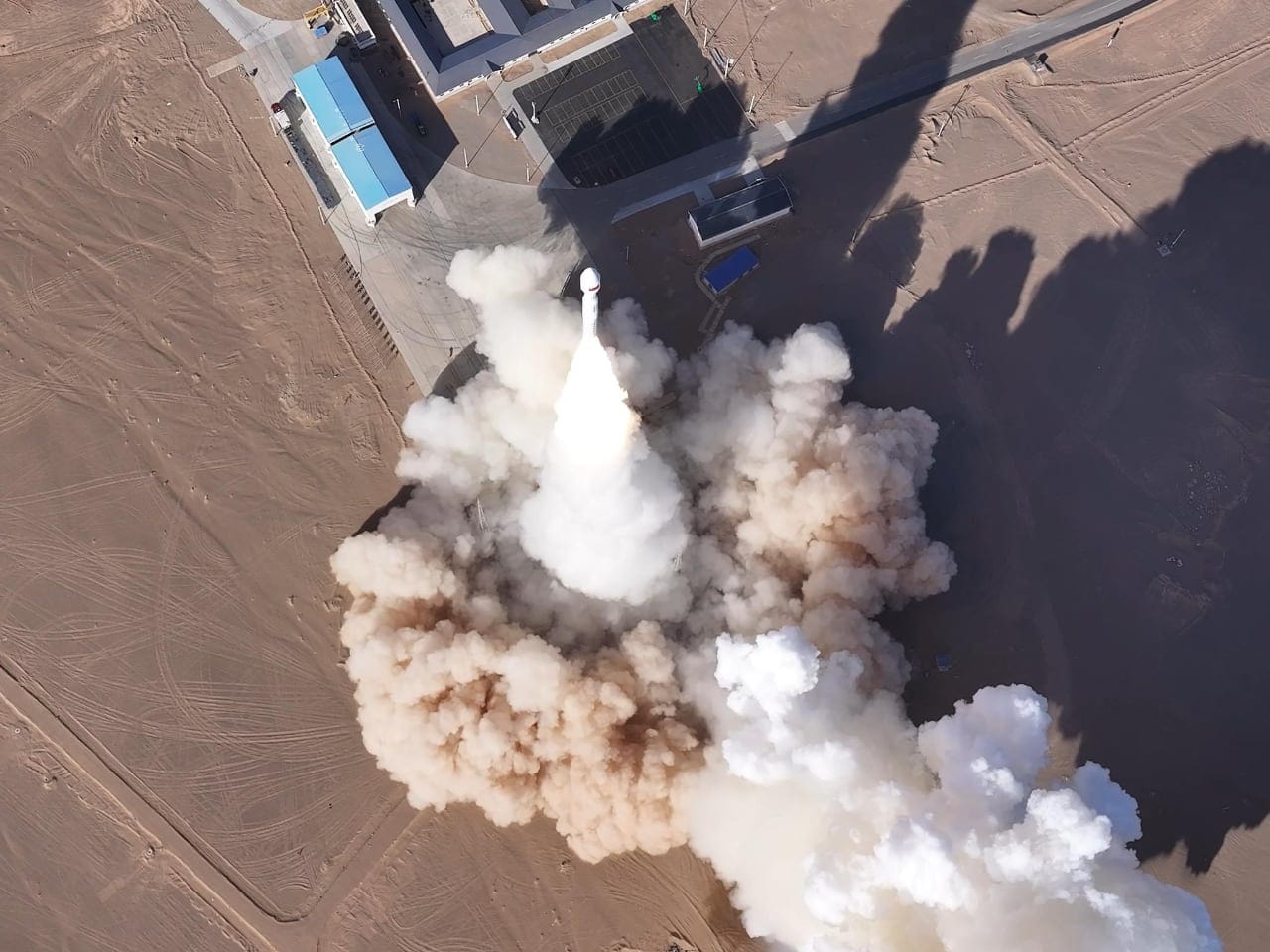
Arab Satellite 813 has successfully launched, and the UAE is framing it as a practical “work satellite” for the region: collect Earth data, share it, and use it for environmental and climate decisions.
The big technical headline is hyperspectral imaging — which is a fancy way of saying the satellite doesn’t just take pretty pictures. It captures detailed “colour signatures” across many wavelengths, which helps identify materials and changes on the ground more accurately.
KEY TAKEAWAYS
- Arab Satellite 813 has launched, led by the UAE, as a joint Arab space initiative.
- It’s the first Arab satellite with hyperspectral imaging, aimed at environmental and climate monitoring.
- It combines HSI + a Panchromatic camera (PAN) + an Atmospheric Polarimeter (AP) for more complete Earth observation.
- Member states in the Arab Space Cooperation Group will get open data to build country-specific tools and a shared regional database.
- The project trained and attracted 10 Arab engineers and researchers, with a focus on long-term capability building.
What Arab Satellite 813 is (and what it’s for)
Arab Satellite 813 is positioned as a joint Arab project to grow regional space skills and cooperation, while using Earth observation to support sustainable development.
- Built to strengthen collaboration among Arab Space Cooperation Group countries
- Supports environmental and climate monitoring via space-based Earth observation
- Helps build regional know-how in assembling and testing microsatellites
- Attracted and trained 10 Arab engineers and researchers
The useful part here is the “capability flywheel”: a real mission that trains people, produces data, and leaves behind teams who can build the next satellite instead of starting from zero every time.
The tech on board: HSI, PAN and AP in plain English
Arab Satellite 813 carries three integrated technologies: Hyperspectral Imaging (HSI), a Panchromatic Camera (PAN), and an Atmospheric Polarimeter (AP).
- HSI (Hyperspectral Imaging): captures many narrow wavelength bands to spot “signatures” of water, soil, vegetation, and more
- PAN (Panchromatic): a high-detail black-and-white style image layer that improves sharpness and mapping
- AP (Atmospheric Polarimeter): helps analyse atmospheric properties (useful when you’re trying to understand climate and air effects)
The UAE Space Agency says the output includes high-resolution data on water, soil, and vegetation, with AI used to support faster environmental decision-making.
What “open data” means for member states
The satellite is expected to provide Arab Space Cooperation Group member states access to open data to develop tailored solutions for their own environmental and climate priorities.
- Open access for member states to build national tools and analysis
- Supports a unified database for Arab environmental and development policies
- Aims to reduce reliance on costly ground-based measurements
In practice, this is about turning satellite data into decisions: measuring coastal pollution, tracking forest health, and improving agriculture monitoring to support food security.
If you’re following how the UAE is building its broader space stack (policy, licensing, and industry support), this fits neatly alongside work like the UAE Space Agency’s sector coordination push and digital licensing steps (both covered on tbreak):
Why this matters for climate, development, and regional science
The release frames Arab Satellite 813 as a climate and environment mission first — and a regional cooperation signal second.
- Supports climate-change understanding and “space-based solutions” powered by AI models and analytics
- Contributes to 10 UN Sustainable Development Goals
- Designed as a platform for scientific cooperation and knowledge exchange
If you want the official SDG list for context, the UN’s SDG hub is the cleanest reference.
And for the broader “UAE is serious about space” context, here are a couple of relevant reads on tbreak (not about 813 specifically, but about the ecosystem being built around missions like it):
For official background on the UAE Space Agency and its missions/projects, you can also check the agency site.
FAQ
What is Arab Satellite 813?
It’s a newly launched Earth-observation satellite announced by the UAE, designed as a joint Arab space initiative focused on environmental and climate monitoring.
What makes Arab Satellite 813 different?
It’s described as the first Arab satellite with hyperspectral imaging, combined with PAN and an Atmospheric Polarimeter for broader Earth observation capability.
What can hyperspectral imaging (HSI) be used for?
In this mission’s context, it’s used to study environmental and climate systems and monitor changes on Earth’s surface with more detail than normal imaging.
Who gets access to the data?
Member states of the Arab Space Cooperation Group are expected to get access to open data to build tailored solutions for their environmental and climate priorities.
How does this help talent development in the region?
The project contributed to attracting and training 10 Arab engineers and researchers, and also aims to build expertise in assembling and testing microsatellites.
Written by

Subscribe to our newsletter
Subscribe to our newsletter to get the latest updates and news


Member discussion